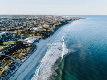
The City of Joondalup is home to 17km of incredible coastline between Marmion and Burns Beach, most of which is adjacent to the Marmion Marine Park. The coastline is varied over this area, and can include rocky limestone cliffs, headlands, nearshore reefs, sandy beaches, pocket sandy beaches and dune systems.
The City's coastline holds significant value for both residents and visitors. In response to potential impacts of climate change, such as erosion and storm surges, the City has initiated efforts to better understand these risks.
Coastal hazards
Definition
Coastal hazards include:
- Coastal erosion: where sediments and sand from beaches and dunes are broken down and moved away by wind, waves and currents. Erosion can reduce the width of a sandy beach and reduce sand dunes.
- Inundation: temporary flooding of coastal areas.
Coastal inundation is not considered a high risk for the City’s coastline and City assets.
There are several areas along the City’s coastline which are already affected by coastal erosion. Coastal erosion risks are likely to worsen into the future due to climate change impacts.
Coastal hazard assessment
A coastal hazard assessment conducted in 2015 focused on the City's coastline, aiming to pinpoint areas susceptible to erosion over the next century. The assessment revealed in the short term, sandy beaches and related infrastructure like access ways and dune fencing may face vulnerability.
Over the long term (beyond 50 years), additional infrastructure such as car parks, select City-owned buildings along coastal foreshore areas, and some private properties could potentially be at risk from severe storm erosion.
Coastal vulnerability notification list
Stay informed about coastal hazard updates and actively participate in shaping the future of the City of Joondalup's coastline.
Sign up for the Coastal Vulnerability Stakeholder Notification list to receive email alerts whenever new coastal hazard information is released and opportunities to contribute to future planning arise.
Caring for our coastline
Coastal hazard areas require planning and development measures including notification on certificates of title and coastal risk management planning before land subdivision. All coastal local governments in Western Australia must adhere to State Planning Policy 2.6, guiding sustainable coastal management. For details on how this policy impacts property owners, refer to the Coastal Vulnerability FAQs (PDF) and the City’s Coastal Local Planning Policy (PDF).
The City undertakes many activities including:
- Rehabilitating dunes, including revegetation with native species, weed control and fencing.
- Installing access ways, paths and signage.
- Feral animal control.
- Fire management.
- Waste management.
- Sand stabilisation and sand drift management.
- Sand bypassing program – annually moving around 8,000m3 of sand that builds up on the beach to the south of Hillarys Boat Harbour, and moving it to the beach that has eroded on the north side of Hillarys Boat Harbour.
- Maintaining existing seawalls and groynes.
- Completing annual coastal monitoring and opportunistic storm monitoring to monitor shoreline movement over time.
There are a number of ways to help care for beaches and coastal areas, such as:
- Join your local coastal Friends Group and help to rehabilitate the coastal reserves.
- Report any sick or injured marine animals or other wildlife to the Wildcare Helpline on 9474 9055.
- Not clear or prune any vegetation and/or remove individual plants from coastal areas.
- Stay out of the dunes to protect native vegetation from being trampled and destroyed.
- Abide by the City’s designated dog exercise areas. Hillarys Dog Beach is the only beach where dogs can be exercised off lead. Dogs are permitted on lead along the coastal dual use path from Burns Beach to Marmion Beach.
- Stay on pathways and ensure you have clean footwear with no soil or other material when visiting any of the City’s coastal parklands and reserves to help reduce the risk of spreading plant diseases.
- Remove any litter you find. You could organise or participate in a Clean Up Australia Day event for your local beach.
- Not drive off-road vehicles along beaches or in the dunes.
- Abide by abalone fishing restrictions, season dates and requirements and only access the beach using formal paths and accessways.
- Report suspicious behaviour to the Police on 131 444 or if you see a fire phone 000.
Dune systems behind beaches support native vegetation, act as erosion buffers and are protected coastal foreshore reserves. These reserves are vital for conservation, with most designated as Bush Forever. They house threatened and priority ecological communities, as well as plant and animal species. The City's coastal foreshore reserves are habitats for various plants and animals, including birds, reptiles, invertebrates and mammals. They also serve as resting and breeding grounds for numerous seabirds, including migratory species protected by international treaties. The City acknowledges the potential impact of future climate changes and sea-level rise on its coastal areas and is actively evaluating coastal hazards and planning responses.
A majority of the offshore waters of the City’s coastline are part of the Marmion Marine Park. The Marine Park covers 9500ha between Trigg Island and Burns Beach and protects a chain of inshore limestone reefs and islands and a range of marine life. The Marmion Marine Park is managed by the Department of Biodiversity, Conservation and Attractions (DBCA).
To view the City’s coastal management plans visit the publications page.
Coastal monitoring
The City has been undertaking a Coastal Monitoring Program since 2015-16 which includes the following elements:
- Beach and hydrographic surveys conducted every two years from behind the primary dune to several hundred metres offshore. A total of 22 profiles are completed over approximately 15km.
- Inspections and photographic monitoring of the beaches within the study area every six months.
- Mapping of the shoreline from aerial photographs taken every year.
- Assessment of the change and impact from any coastal management activities, such as sand bypassing.
- Analysis of the monitoring surveys by experienced and professional coastal engineers, identifying areas of accretion or erosion.
- A report on the monitoring results and analysis each year, highlighting notable variations in shoreline movements.
The Joondalup Coastal Monitoring 2023-24 Data Report provides the results of the 2023-24 Coastal Monitoring Program and analysis of shoreline change since the baseline year of 2015-16. The Coastal Monitoring Program operates on a two-year schedule with a full comparative analysis and report provided every second year and an annual report without survey comparisons in the intervening years. A full report is provided in 2023-24 and is available below.
The key recommendations based on the coastal monitoring data and assessment for 2023/24 include the following:
- Continue to specifically monitor and actively manage (if required) erosion between and including Hillarys Beach Park and Pinnaroo Point.
- Continue to specifically monitor the shoreline movement at Burns Beach.
- Continue to complete annual sand bypassing around Hillarys Boat Harbour increasing the volume to around 15,000m3 in response to erosion at Hillarys Beach Park and Pinnaroo Point.
- Commence investigation of long-term adaptation options for Hillarys Beach Park and Pinnaroo Point.
The following actions have been taken toward the implementation of the recommendations:
- Ongoing maintenance of the City’s coastline including removal or relocation of dune fencing and regrading of beach access ways.
- Ongoing support for coastal Friends Groups to conduct revegetation of coastal foreshore reserves including the provision of local provenance species.
- Continued implementation of the annual Sand Bypassing Program from Sorrento Beach to Hillarys Beach Park in 2024/25.
- Conducting a sand bypassing options assessment to consider long term alternatives to the current Sand Bypassing Program at Hillarys.
- Continued implementation of the Coastal Monitoring Program to monitor changes to the City’s shoreline area and assist with management of the City’s coastal assets.
- Continued participation in the Northern Beaches Alliance with the Cities of Wanneroo, Joondalup, Stirling and Nedlands, the Town of Cambridge and the Shire of Gingin to investigate coastal issues on a regional scale.
Coastal hazard map
The coastal hazard map below show areas that have been identified as potentially subject to coastal hazard risk within a 100-year planning timeframe.